Map Reference: G-19
Shark Bait Cove is a Large Island in The Ancient Isles.
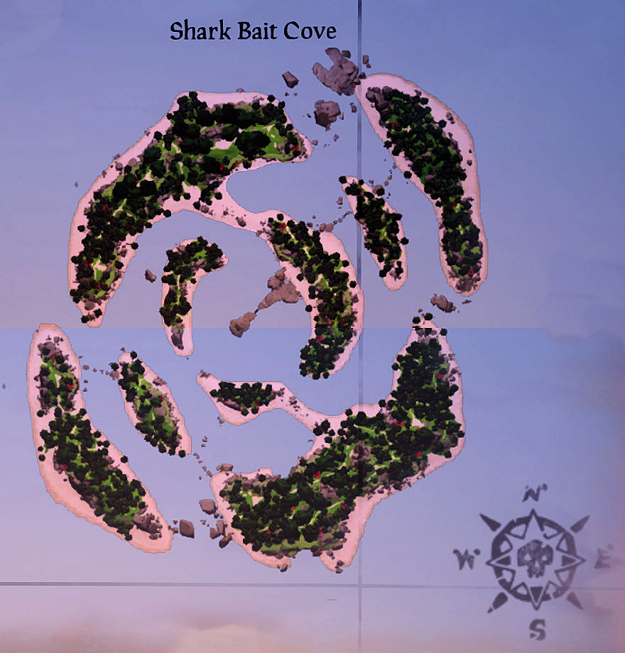
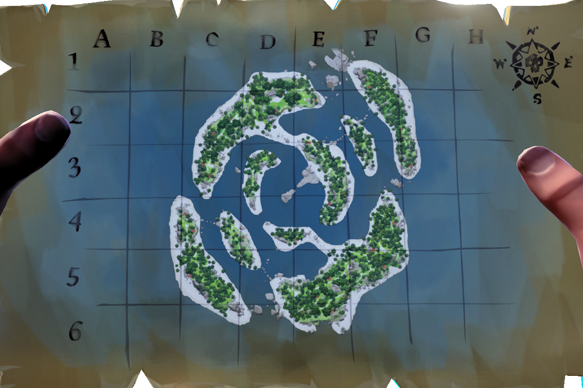
Below is a list of key phrases indicating landmarks on Shark Bait Cove. These key phrases will be woven into clues, often in the form of rhyming couplets. Click on the phrase itself to see a map and screenshot. Click on these for a bigger view. The screenshots are designed to show the landmark at its best. For most landmarks, especially larger ones, you will have to move closer than the point from which the screenshot was taken.
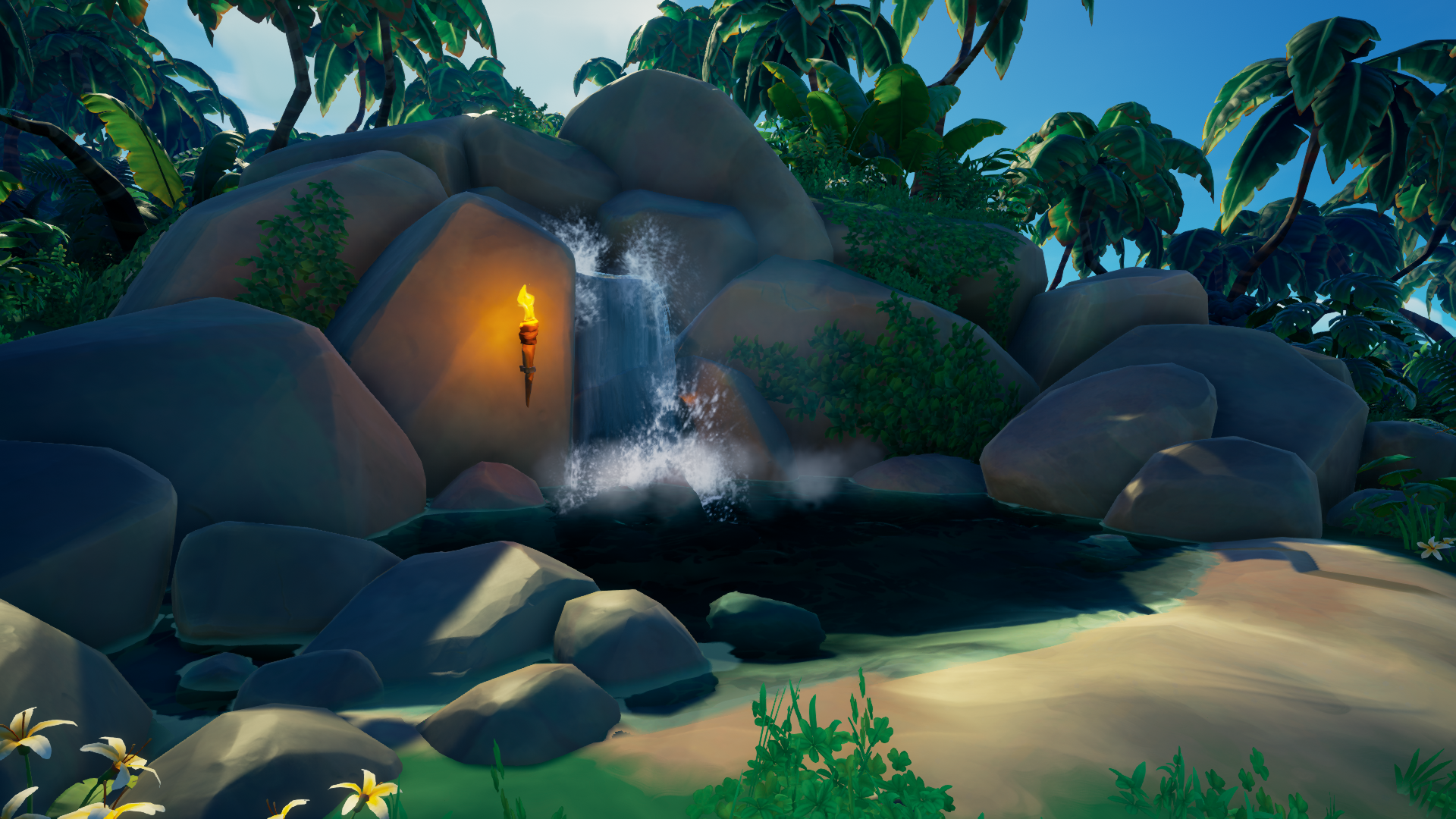
![]() at the top of the waterfall on the South East outer ring
at the top of the waterfall on the South East outer ring
![]() Seashell Rock on the South West inner atoll
Seashell Rock on the South West inner atoll
![]() the barnacled chests on the North West inner ring
the barnacled chests on the North West inner ring
![]() the campfire at the remains of the fishing camp on the South West shores
the campfire at the remains of the fishing camp on the South West shores
![]() the entrance to Sharkbait Cave
the entrance to Sharkbait Cave
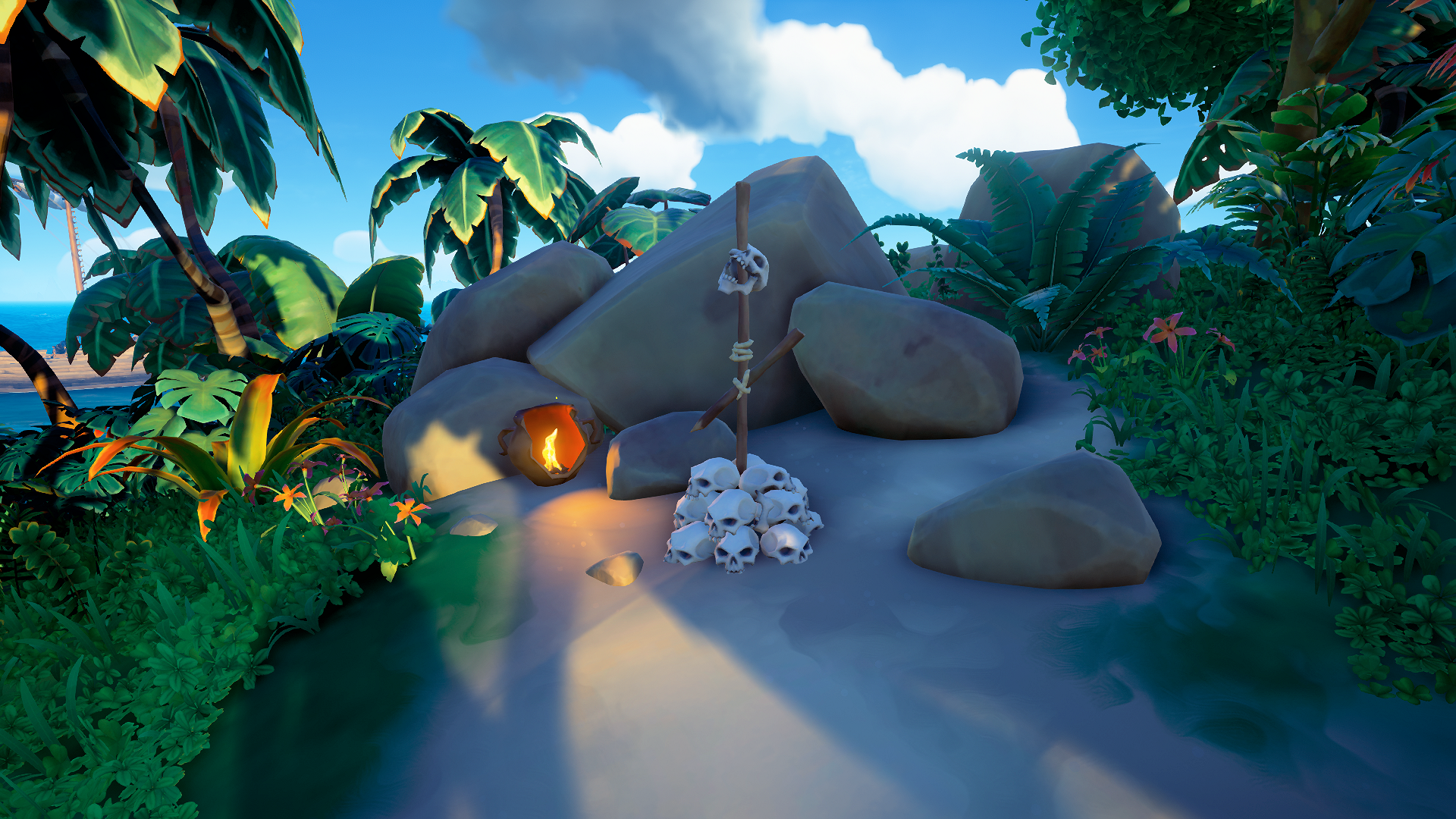
![]() the fisherman’s grave on the North West outer ring
the fisherman’s grave on the North West outer ring
![]() the looted stores on the West outer ring
the looted stores on the West outer ring
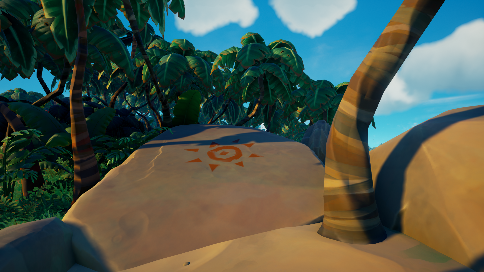
![]() the painted adventurous divers on the North outer ring
the painted adventurous divers on the North outer ring
![]() the painted stingray on the South inner ring
the painted stingray on the South inner ring
![]() the remains of fishing camp on the South West shores
the remains of fishing camp on the South West shores
![]() the Rumrunner's Cache on the North West outer ring
the Rumrunner's Cache on the North West outer ring
![]() the Seahorse Lookout on the East outer ring
the Seahorse Lookout on the East outer ring
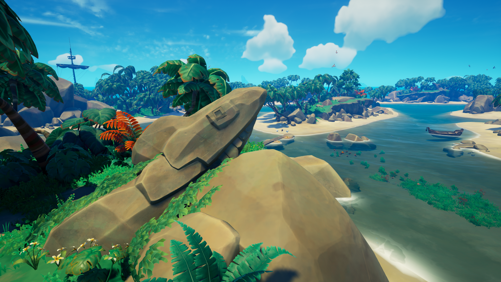
![]() the shark statue on the East outer ring
the shark statue on the East outer ring
![]() the shark statue on the North outer ring
the shark statue on the North outer ring
![]() the shark statue on the South outer ring
the shark statue on the South outer ring
![]() the shark statue on the West outer ring
the shark statue on the West outer ring
![]() the shores of the waterfall on the South East outer ring
the shores of the waterfall on the South East outer ring
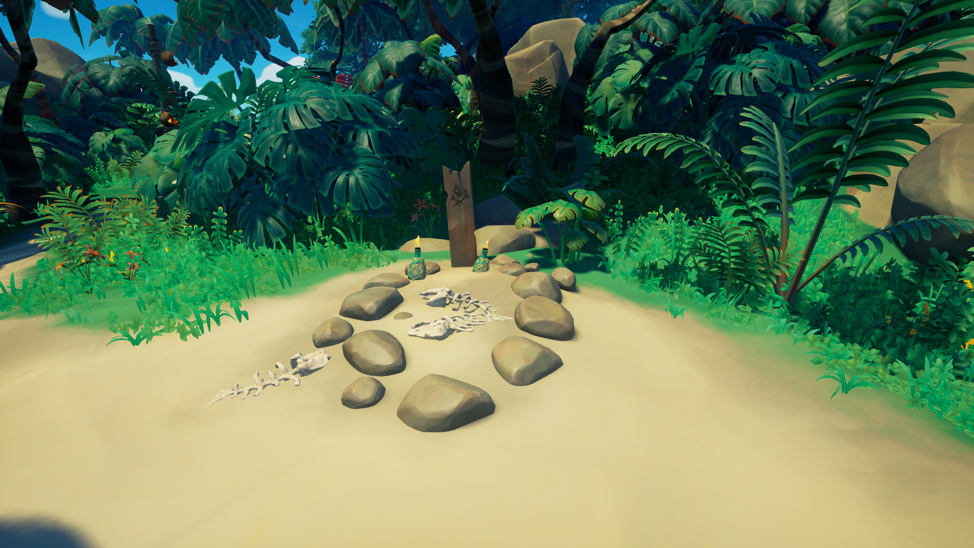
![]() the skull summoning totem on the South east outer island
the skull summoning totem on the South east outer island
![]() the spearfisherman looking to the South West sea
the spearfisherman looking to the South West sea
![]() the three fishermen overlooking the eye of the island
the three fishermen overlooking the eye of the island
![]() the top of the waterfall on the South East outer ring
the top of the waterfall on the South East outer ring
![]() the twin fish boulder on North West outer ring
the twin fish boulder on North West outer ring
![]() the twin red sharks inside Sharkbait Cave to the North... underground
the twin red sharks inside Sharkbait Cave to the North... underground